

2018-2019
Blue Vision Labs (acq'd by Lyft)
I helped scale camera-based mapping from three city pilots into a two-country operation that supplied a 3D map pipeline for Lyft Level 5.
Tested, redesigned, deployed, and scaled field capture systems.
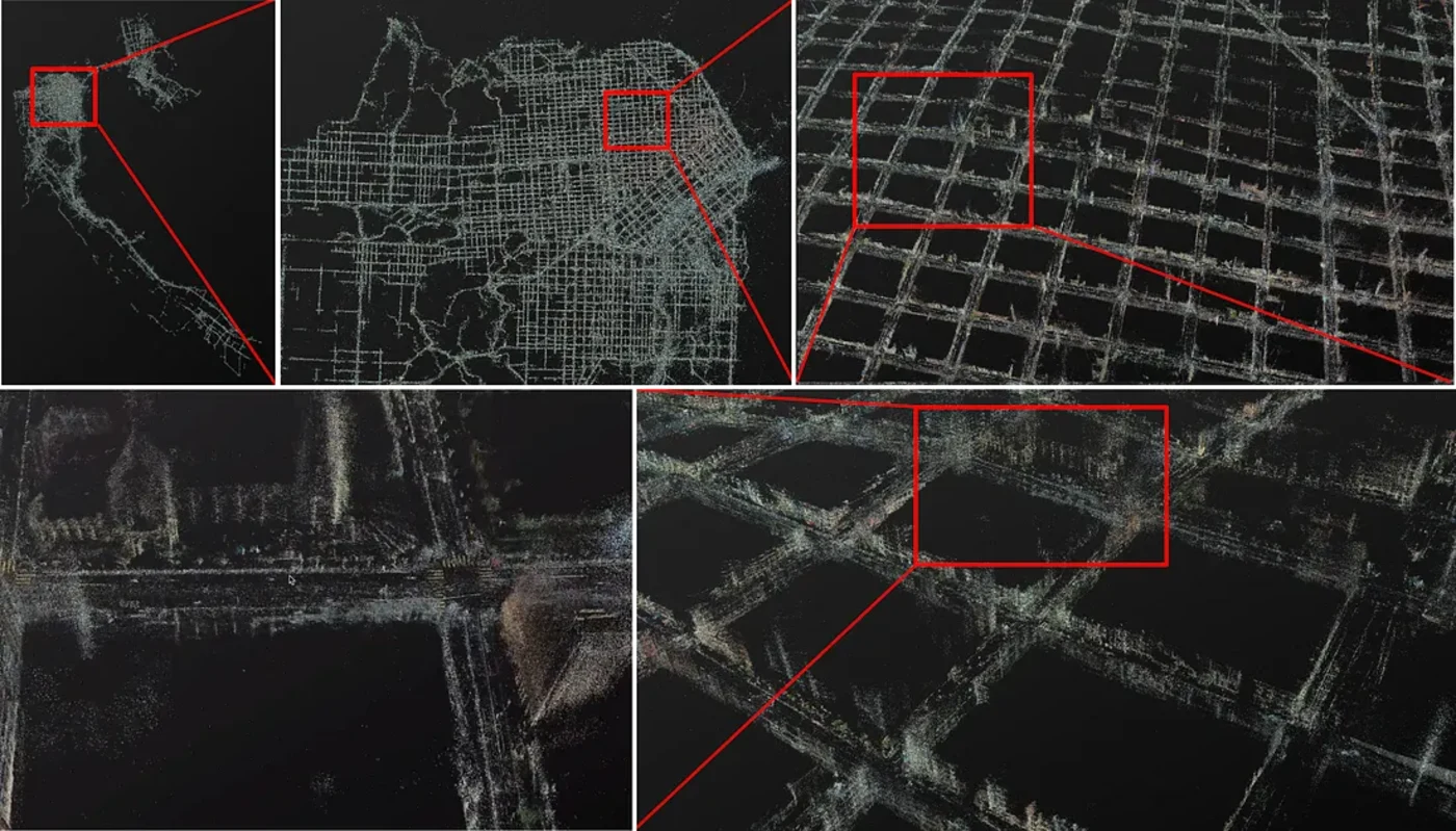
City-scale 3D maps from real-world fleet capture.
Helped produce a major public autonomous-vehicle street dataset.
 View full-size artifact
 What Was Built
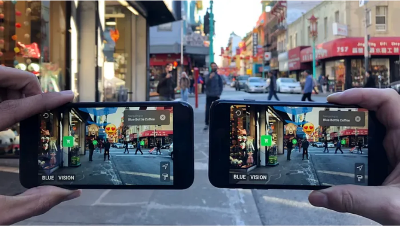
Blue Vision Labs built visual positioning and AR Cloud technology that let phones localize against high-accuracy city maps and anchor shared, persistent AR. Lyft acquired the company because the same computer-vision stack could accelerate Level 5 mapping and localization: detailed 3D maps of cities from camera-phone imagery, not only expensive lidar rigs.
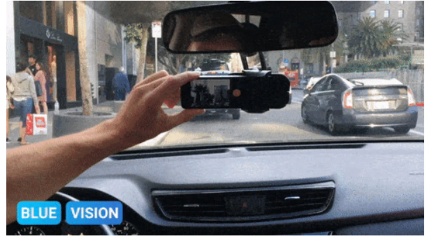
My work sat in the operational layer that made that promise real: getting capture hardware into vehicles, collecting useful street data, and improving the pipeline between field collection and downstream mapping.
My Role
I helped test, improve, and scale the mapping operation across the U.S. and U.K. The role expanded from field testing into sensor redesign, vendor and part selection, mounting decisions, data-ingestion optimization, fleet deployment coordination, and privacy/compliance work around international camera data capture.
The work required constant tradeoffs across hardware reliability, field conditions, cost, heat, capture quality, latency, driver behavior, privacy constraints, and downstream mapping usefulness. A collection system that works in a lab is not the same thing as one that works across cities, vehicles, routes, weather, tunnels, and real operators.
How We Measured Success
A mapping program is only as good as the data that survives the trip back. Four things had to hold:
- Capture had to survive real conditions. Heat, tunnels, bad lighting, mounting variation, and driver behavior all had to be handled by the rig, not designed around.
- Collected had to mean usable. Volume was not the metric. Data had to be good enough for the downstream mapping pipeline to actually consume.
- Cost had to stay below dedicated mapping vehicles. The entire premise was camera phones in ordinary fleet vehicles instead of specialized lidar rigs.
- Privacy had to hold across two jurisdictions. Street-level camera capture in the U.S. and U.K. had to satisfy both, not just one.
The program scaled from 3 city centers to 2 countries and helped create up-to-date city-scale 3D maps for simulation, localization, trajectory analysis, and autonomous-vehicle development.
The broader Lyft Level 5 program later released what it described as the largest publicly released dataset of its kind: 55,000+ human-labeled 3D annotated frames, data from 7 cameras and up to 3 lidars, a drivable surface map, and an HD spatial semantic map. My contribution was not research-model work; it was the practical collection, ingestion, and field-operations layer that makes city-scale datasets and maps possible.
Why It Mattered
Autonomous vehicles need real-world data at scale, but real-world collection is messy: heat, tunnels, bad lighting, mounting variation, driver behavior, privacy constraints, and hardware failures all affect whether the data is useful.
The value was turning ordinary fleet activity into a lower-cost mapping network that could collect useful data across markets without relying only on specialized mapping vehicles.
What This Proves
I can operate where software, hardware, compliance, and field operations collide. The pattern is the same one I keep repeating: take messy real-world data, make the system observable, and scale it without losing trust in the output.